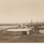
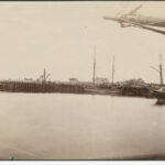
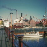
For over half a century Port Adelaide’s Jervois Bridge was the only link by which pedestrians and wheeled vehicles could transit between the Port and Lefevre Peninsula. Constructed in the late 1870s on the footprint of an earlier wooden footbridge, it comprised an innovative ‘swing bridge’ mechanism that allowed watercraft to pass through and access maritime infrastructure located on the upper reaches of the Port River. Despite some shortcomings in its design and operation, Jervois Bridge was celebrated for the savings in time and money it granted to those who regularly utilised it. Following the opening of the Birkenhead Bridge in the 1940s, Jervois Bridge fell into disuse and disrepair, and was replaced by a modern fixed span in the 1960s.
Origins
The need for a fixed link between Port Adelaide and Lefevre Peninsula was acknowledged by South Australian residents and officials during the colony’s earliest years. In the 1830s and 1840s it was common for arriving ships to discharge passengers and mail on Lefevre Peninsula’s western shoreline during periods of calm weather. The passengers would then undertake a 1.5-kilometre overland journey to the western bank of the Port River, where they employed watermen to ferry them across to Port Adelaide. In the meantime, the vessel from which they disembarked would enter the river and gradually make its way upstream to the Port. In many cases, passengers often arrived at their destination one or more days before their ship moored at one of the wharves along the waterfront. It was the needs of these individuals for a safe, convenient means of crossing the river that provided initial incentive for a bridge linking the Port and peninsula.
The ‘Port Bridge’
Meetings advocating the establishment of a bridge across the Port River occurred as early as July 1854, but considerable disagreement existed as to where it should be constructed. Proposed locations included Mundy Street, Todd Street, Commercial Road and Nelson Street. A committee of prominent Port Adelaide residents and business owners initially suggested that a stone bridge be built between Mundy Street and ‘the line of road below [H.C. Fletcher’s] patent slip’ (today’s Fletcher Road). However, by the next meeting in August 1854 the majority of committee members instead favoured a bridge site at the western terminus of St Vincent Street, and opted for a reduced span 30 feet (9 metres) wide and manufactured entirely of wood.
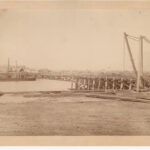
Ultimately, an altogether different plan was accepted by the colonial government, which agreed to construct the bridge and cover the majority of its costs, provided £1500 of the total amount was covered by local subscription. In its final configuration, the span was constructed of imported Tasmanian timber and had a length and width of 708 feet (216 metres) and 10 feet (3 metres), respectively. It featured a central drawbridge mechanism that was operated via a series of hand-powered ‘crab-winches’. When fully elevated, the drawbridge allowed passage for vessels as wide as 28 feet (8.5 metres). Kensington-based builder CA Perry was responsible for assembling the bridge.
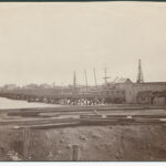
Opened in early 1859, the structure was officially christened the ‘Port Adelaide and Lefevre’s Peninsula Bridge’, but was known colloquially as the ‘Port Bridge’. Within a very short time, plans were made to create a township (aptly named ‘Portbridge’) from allotments laid out along the span’s western approach, but these efforts appear to have been premature at best. By May 1859, local newspapers were decrying the ‘disgraceful state’ of both approaches, and observed that the ground on the western side of the bridge was so saturated and muddy it was ‘quite impassable’ to horses and horse-drawn carts and carriages. For the remainder of its existence, the Port Bridge was plagued by maintenance issues, and was a frequent target of complaints. The drawbridge mechanism worked so poorly that it was reportedly only used once. In 1869, part of the deck structure collapsed beneath a horse that was crossing overhead. As the number and severity of complaints against the bridge increased, the government was finally compelled to take action.
The Original Jervois Bridge
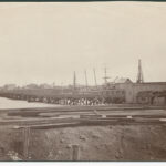
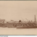
In 1874, the South Australian Parliament passed a bill authorising construction of a new bridge across the Port River. The government also acknowledged that the new span provided an excellent opportunity to extend the pre-existing railway in Port Adelaide to Semaphore, and ordered that it be built to accommodate rail traffic in addition to pedestrians, horses and wheeled vehicles. Construction commenced in July 1875 with the placement of Jarrah support piles within a corridor immediately south of the existing bridge. Originally, the Port Bridge was to be left in place while the new span was being built. This was done in an effort to maintain continued movement of people and goods across the river. However, dredging and pile-driving activities associated with the new bridge weakened the existing structure to such an extent that a temporary timber span was built 25 metres upstream from the construction site. Erection of the temporary bridge commenced in August 1875, and was carried out in conjunction with demolition of the Port Bridge and deepening of the adjacent shipping channel.
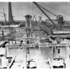
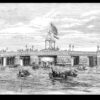
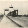
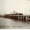
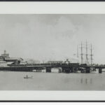
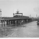
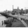
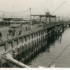
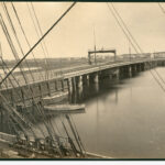
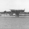
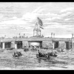
The new bridge was fabricated from iron components manufactured by English company Westwood, Baillie & Co. It featured a central ‘swing’ span mounted on a turntable that could be rotated 90 degrees to allow vessels to pass through the bridge. The swing span’s operation was controlled from a wooden tower mounted on a steel gantry that crossed the bridge laterally along its central pier. From this position, the bridge operator had a clear view of both the river and adjacent roadways. A hydraulic mechanism designed by Sir William Armstrong & Co. of Newcastle-on-Tyne rotated the swing span and was originally powered by a steam engine. Although weighing approximately 600 tons (600 000 kilograms), the swing mechanism was reportedly ‘so perfect that it [could] be opened and closed with the utmost ease’. When rotated to the ‘open’ position, the swing span created a void measuring 47 feet, 6 inches (14.5 metres) through which one or more vessels could pass.
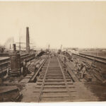
In terms of overall length, the new bridge measured 320 feet (97.5 metres) between abutments. Its maximum width was 38 feet (11.6 metres). Pedestrian lanes measuring 6 feet, 6 inches (2 metres) across were situated along the periphery of each side of the bridge, and were separated from vehicle traffic by ornamental iron balustrading. Railway tracks occupied the centre of the bridge and were separated from vehicle traffic by cast-iron kerbs.
Placement of railway tracks on the approaches to either side of the bridge was completed by September 1877, and the first test of its structural integrity occurred on 31 December, when a locomotive pulling four trucks and twelve carriages successfully crossed the span. The first passenger train service to Lefevre Peninsula commenced on 3 January 1878 and ferried approximately 500 people between Port Adelaide and Semaphore. An official opening ceremony for the new bridge took place on 7 February 1878 and was led by South Australian governor Sir William FD Jervois, for whom the span was named. The Jervois Bridge was the first to employ a swing mechanism in Australia, and the only example of its kind erected in South Australia. Although originally estimated to cost £36 300, the bridge’s final price tag (£65 000) was nearly twice that amount.
Issues and Alterations
While there were definite advantages associated with the new bridge, it also featured its fair share of problems. One recurring example was the need to close off the water and gas mains that crossed the bridge every time the swing span was opened. The hydraulic mechanism that powered the swing span was also notoriously slow, and required a minimum of two hours for its boilers to build sufficient steam to move it. This resulted in the bridge being closed to pedestrian, road and rail traffic for up to 15 minutes at a time. Initially, the swing span was only opened infrequently, but following construction of the Portland Canal, Corporation Wharf and Cable Company Wharf on the Port River’s upper reaches, its use steadily increased. Pedestrians frustrated by frequent closures ultimately persuaded the government to construct a set of ferry steps adjacent to either end of the bridge. Another adaptive strategy known as the ‘Drop-Funnel Fleet’ was developed by a group of small boat operators. The ‘fleet’ comprised modified steam launches with an ingenious fold-down funnel that enabled them to pass beneath the span unhindered. Mariners operating these vessels were able to avoid fees and lengthy delays associated with the bridge’s operation.
As Jervois Bridge aged, its swing span developed a tendency to jam—particularly during the hot weather of the summer months. On one occasion in 1933, the tug Vigilant was summoned to force the span open so that a ketch could pass through unhindered. The same mechanical failure that prevented the bridge from opening also kept it from closing again, which necessitated the use of another tug to complete the task. While tugs were used to rectify the problem on more than one occasion, it was far more common for the Port Adelaide Fire Brigade to cool the bridge’s expanded metal components with their fire hoses during periods of excessive heat.
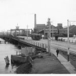
In June 1911, the railway line to Lefevre Peninsula shifted 500 metres upstream to the newly-constructed Port River Railway Bridge, but this hardly spelled the end for rail services on the Jervois Bridge. An electric tramway was installed on the footprint of the former train line in April 1917, and the old tracks were shifted to the north side of the bridge, where they continued to be used by goods trains travelling from Port Dock Station along St Vincent Street. The same tracks gained a degree of notoriety when they accommodated the Royal Train carrying His Royal Highness Prince Edward (later King Edward VIII) from Adelaide to the Outer Harbour at the conclusion of his 1920 visit to South Australia.
The last major modification to Jervois Bridge occurred in early 1937, when the control tower and its support gantry were elevated to permit double-decker trolley buses use of the bridge. A 60-ton floating crane operated by the South Australian Harbours Board lifted the gantry and tower into the air while steel castings measuring 2 feet, 6 inches (0.8 metres) high were bolted to the existing bridge superstructure. The gantry was then lowered onto the castings and fixed in place. Three years later, the Birkenhead Bridge opened and effectively ended the Jervois Bridge’s 62-year monopoly on road and pedestrian traffic across the Port River. From this point onward, the span entered a period of steady structural decline that resulted in speed and weight limits being placed upon it, as well as re-routing of all trolley bus services to the Birkenhead Bridge.
Today’s Jervois Bridge
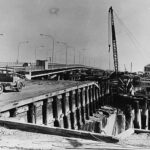
Despite its poor overall condition, the original Jervois Bridge remained in use until August 1966, when it was officially closed to make way for a modern medium-level fixed span. The new bridge was constructed on an alignment a short distance upstream from its predecessor, and assembled from sixteen spans of pre-stressed concrete girders with a combined overall length of 340 metres. It comprised four lanes designed to carry road traffic from St Vincent Street over the Port River, Wirra Drive, the Outer Harbour railway and Causeway Road before joining with Hart Street on Lefevre Peninsula. The new Jervois Bridge officially opened on 28 July 1969, and demolition of its predecessor commenced shortly thereafter.
On the orders of Port Adelaide’s City Engineer W.B. Hagan, the old Jervois Bridge control tower and its supporting gantry were removed and retained when the span was demolished. The structure was subsequently moved to Nile Street, where it currently serves as an entrance archway to the Port Dock Markets car park. An Australian Institute of Engineers historic marker that commemorates the original Jervois Bridge was placed adjacent to the gantry and unveiled in a ceremony on 16 October 1994.





Comments
4 responses to “Jervois Bridge”
Thanks to a new apartment block to be built on its current site we are shortly going to be removing, restoring and relocating the control tower to a site by Harts Mill, close to its original site. Do you have any issues with my pinching much of these photos and text to use in an interpretive panel?
Hi Tom,
Many of the images here come from the State Library of South Australia. If you click on the media button you can see the images with captions and citations. Anything that is listed as from History SA collections is released under Creative Commons copyright as specified in our copyright page (link below) unless the image citation specifies otherwise.
We’d love to hear more about your interpretive panel.
Hi. I was trying to find out where this original Jervois Bridge started in Hart Street and finished in Port Adelaide. I remember the bridge was almost in a straight line from one end to the other.This would mean the current bridge would have been built to curve around it accordingly. I havent seen a map showing the original bridge at either end.Hart Street was a straight road from The Esplanade onward.Can anyway help there? I was a child when the original bridge still existed and the new one completed.
Thank you.
Regards Chris.
Hi Chris,
I’ve forwarded your question to Adam Paterson, curator at the SA Maritime Museum, as he may know more about this than me!