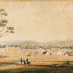
Geographical position and distance have strongly shaped the European history of South Australia. That Adelaide was the last of Australia’s six colonial capitals to be founded – almost half a century after Sydney – was partly an effect of geography. Adelaide lay on a deep indentation far from the nearest sealane to and from Australia and thus had no potential military or commercial use as a sea base.
At the same time, that indentation – and the penetrating fingers of the twin gulfs of St Vincent and Spencer – eventually conferred advantages on South Australia. In an era when water transport was far cheaper than land transport, the gulfs enabled ships to sail close to the major natural resources of copper deposits and wheat lands. The continent’s first major mines were opened in South Australia partly because they lay within an easy journey by bullock-dray to the coast. Kapunda and Burra in the Mid North, and later Moonta and Kadina on Yorke Peninsula, gained enormously because it was cheap to carry copper ore and concentrate to the nearby ports.
Benefits to Mining and Agriculture
The twin gulfs boosted the colony’s development. By 1850 the straggling copper town of Burra, 140 kilometres north of Adelaide, was the biggest inland town in AustralGeographical position and distance have strongly shaped the European history of South Australia. That Adelaide was the last of Australia’s six colonial capitals to be founded – almost half a century after Sydney – was partly an effect of geography. Adelaide lay on a deep indentation far from the nearest sealane to and from Australia and thus had no potential military or commercial use as a sea base.ia, in part due to its proximity to safe ports. South Australia became the nation’s main producer of iron ore between 1900 and 1960 partly because Iron Knob and adjacent deposits almost overlooked Spencer Gulf. Port Pirie, on the same gulf, became one of the busiest silver–lead smelters in the world because it was the closest port to Broken Hill in New South Wales.
The prevailing price of a tonne of wheat could not justify the high cost of a long haul to a distant port, and so the inland wheat regions of Victoria, New South Wales, Western Australia and far-southern Queensland were not tapped until long railways crossed the Great Dividing Range. In contrast, South Australia’s potential wheat land lay relatively close to the coast. Cheap transport more than anything spurred the rise of its wheat industry. Its early farmers were also the first to find an economical way of tilling and harvesting the phosphate-deficient soils which were to prove typical of the wheat lands of inland Australia.
It is little realised that by the 1860s the three more populous Australian colonies depended on contrasting reservoirs of natural resources. Victoria and New South Wales depended on the high-value exports of wool and gold that could carry the cost of expensive transport. On the other hand, South Australia depended less on wool, not at all on gold, and heavily on copper and wheat – commodities that required cheap transport, which the two gulfs provided.
Inland Exploration
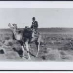
Adelaide’s central, indented position on the southern coast of Australia also enabled it to be a spearhead of inland exploration. Here, on 18 June 1840 Edward John Eyre initiated what Governor George Gawler, in farewelling him, described as ‘one of the most important undertakings that remain to be accomplished on the face of the globe – the discovery of the interior of Australia’ (cited in History of South Australia, p. 297). In the next quarter century, Charles Sturt, John McDouall Stuart, John McKinlay and other South Australians did much to unveil the dry interior long inhabited by Aborigines. It was a sign of the difficulty of these explorations that Uluru (initially christened Ayers Rock after a South Australian premier) was not discovered by the white settlers until Adelaide itself had been settled for more than 30 years. South Australia’s success in exploring much of the interior gave it the opportunity to colonise – for half a century – the vast Northern Territory, whose new capital of Port Darwin lay, by the normal sea route, further from Adelaide than from any other Australian capital city. It was almost like Quebec governing New Orleans, or Massachusetts annexing Colorado. Distance spurred South Australia to be a vigorous explorer, but distance also denied it the fruits from some of its discoveries.
Advantages of Distance to South Australia
Exploiting its geographical position, Adelaide became like a large spider, spinning long webs of commerce into the territory of rival colonies. South Australians used the new paddlesteamers and the River Murray to tap wealth from southern and western New South Wales. Adelaide became the terminus of the overland telegraph linking it to northern Australia and the outside world. Broken Hill, though within New South Wales, was largely settled and supplied by South Australians; and most of its clocks (but not the post office) followed their time.
Two South Australians – William Brookman and Samuel Pearce – discovered the rich southern half of the Kalgoorlie goldfield in Western Australia, and much of its early wealth came to Adelaide. The most famous of the early Kalgoorlie mines, Great Boulder, actually borrowed its name from a small gold mine at Dashwood’s Gully near Adelaide. In like manner, in the late 1950s the new Adelaide-based explorer, Santos, began to find, on both sides of the north-eastern borders of the state, the natural gas and oil that eventually made it the state’s most important public company.
Adelaide’s spider-web of commerce, quietly transcending state boundaries, gave the city the largest hinterland in the continent. For a long time South Australia was known as ‘the central state’. The idea of centrality was one reason why so many South Australians were ardent federalists in the 1890s: it was their hope that in the new continental common market they would be the pivot. As late as the year 2000 the firm plans for the long railway linking Adelaide, Alice Springs and Darwin gave many South Australians the hope that the central position of their state would provide a new impetus. Just as the telegraph line, opened in 1872, had made Adelaide the portal to South-East Asia, so the north–south railway of the early 2000s might tap the commerce of South-East Asia and thereby revitalise Adelaide.


Comments