

South Australia essentially is a lowland occupying an area of almost 1 000 000km2. About 85% of this area is occupied by plains (as shown on the morphological map in the Atlas of South Australia). Even the ‘mountains’ developed on exposures of ancient granitic and folded sedimentary rocks are modest by any but Australian standards. The highest point is Mt Woodroffe in the Musgrave Ranges in the far north of the state, which stands only 700–800m higher than the adjacent plains and a mere 1435m above sea level: this compares with Mount Kosciuszko at 2227m above sea level, Australia’s highest peak; 3764m for Mt Cook, the highest peak in New Zealand; and the Carstenz Mountains of New Guinea which rise to 5030m above sea level.
The first accounts of South Australian landforms and landscapes are due to the explorers who were concerned not only to discover what was there but also whether the land held any promise for farming and mineral wealth.
Explorers and perceptions
For Europeans and Americans the first sights of what was to become South Australia were impressive but uninviting, for they approached from the sea and encountered spectacular but forbidding cliffed coasts and beaches backed by bleak sand dunes. Matthew Flinders and Nicholas Baudin were concerned to complete mapping the outlines of ‘Terra Australis’, a task begun by various Dutch and British mariners in the west and south, and by James Cook (and possibly and earlier by Portuguese seamen) in the east. They sought a major river or rivers draining from and leading into the centre of what was evidently a large compact land mass. How their hopes must have risen when they entered the wide openings of Spencer Gulf and Gulf St Vincent, only to have them dashed as the land closed in on them from both east and west. Nevertheless, apart from the American whalers’ stations on Kangaroo Island, the first European settlements, at Port Lincoln and Adelaide, took advantage of the comparatively sheltered waters of the gulfs.
There was from the beginning of colonisation a search for inland seas, lakes, and rivers and, as a corollary, for land suitable for arable and pastoral farming. The settlement of the interior followed hard on the heels of the explorers, and the possibility of mineral wealth was not overlooked.
Mineral exploration
The visit of a professional geologist, ARC Selwyn, in the search for minerals in the Mt Lofty and Flinders Ranges in 1859 came after South Australia’s mining tradition had begun.
Diamonds were found at Echunga, but the source was not located. Gold was discovered in small quantities at many sites, but the Kapunda and Burra copper fields were the basis of early prosperity. Later and recent discoveries confirmed minerals as one of the pillars of the South Australian economy, with copper found also at Moonta–Wallaroo on northern Yorke Peninsula, and at many other sites such as Prominent Hill in the north of the State. Iron deposits have been exploited in the Middleback Ranges of northeastern Eyre Peninsula and extensive magnetite deposits have been located in central Eyre Peninsula south of Warramboo, but await development. The undoubted jewel in the mineral crown, however, is the Olympic Dam copper–uranium–gold–silver deposit, which is of global status and a reward for a brilliant piece of geological detective work.
In addition to these metalliferous ores, opal is found in association with sedimentary basins around Coober Pedy, Andamooka, and Mintabie. Important gas fields have been exploited around Moomba, and brown coal deposits are mined in small basins near Leigh Creek, in the central Flinders Ranges. Most important, however, the sedimentary basins contain valuable reserves of water, particularly in the Great Artesian Basin of northeastern South Australia.
Unfamiliar landscapes
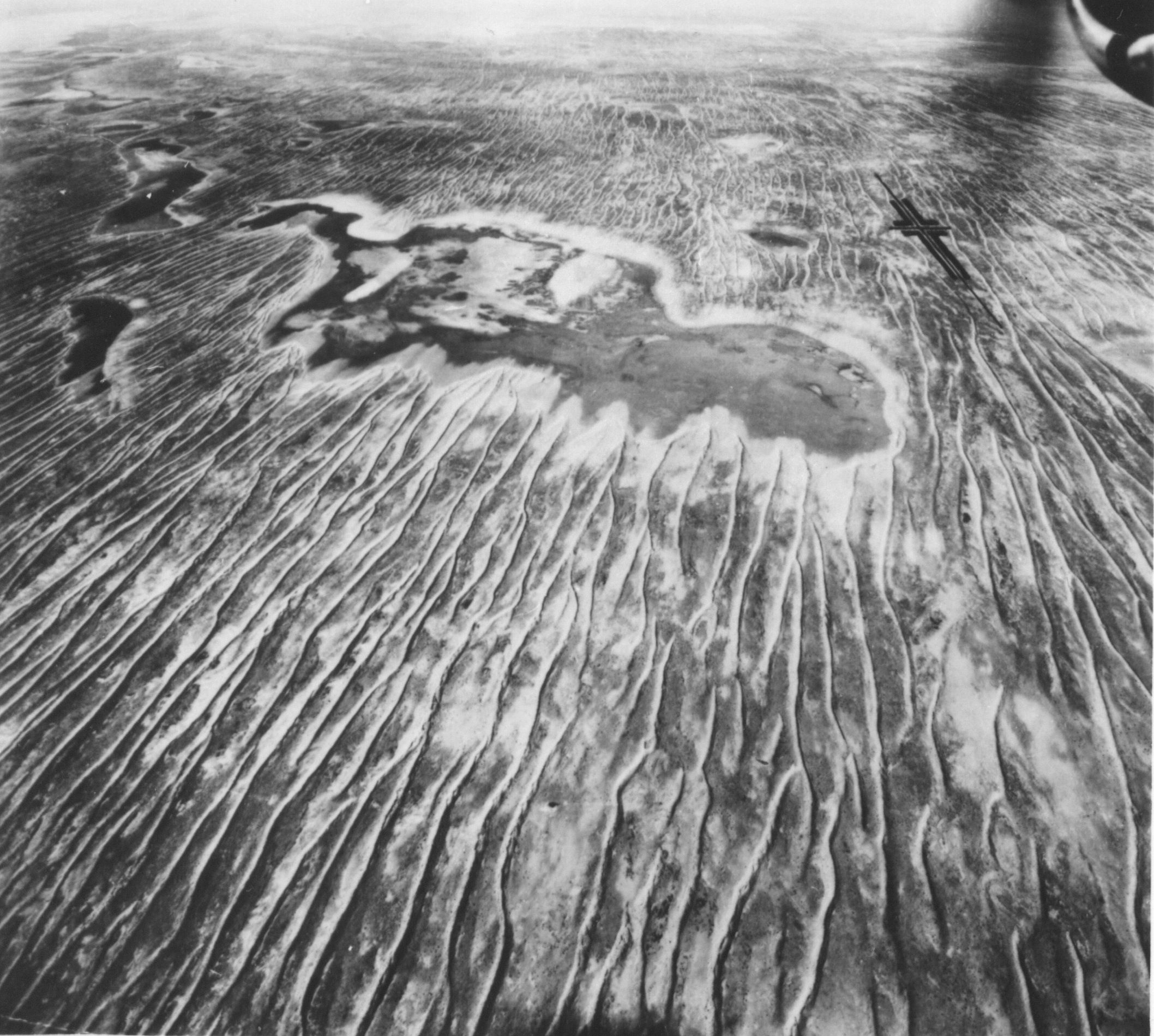
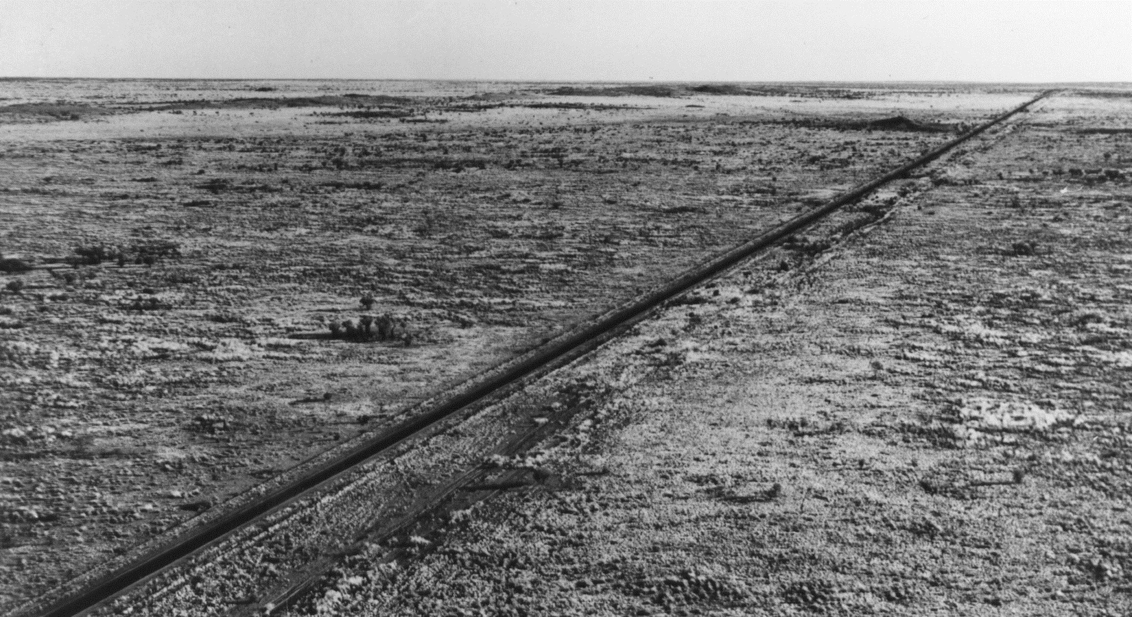
The early European explorers and settlers found themselves in harsh environments, most of which were outside their previous experience. Ernest Giles described part of the eastern Great Victoria Desert as ‘a fearful place, the ants, flies and heat being each intolerable’. And nothing could have prepared Charles Sturt and his party for the temperatures they endured in the summer of 1845–46 in the Strzelecki Desert, and he was with good reason bewildered when he encountered the stony or gibber desert that now carries his name, and which he described as ‘gloomy, stone-clad, and adamantine’. He admitted he was ignorant of the existence of a comparable feature anywhere else in the world. He was also baffled by the fields of parallel sand ridges he encountered (Figure 3), concluding that they had been shaped by waves and had formed on an old seabed.
Notwithstanding, later generations of South Australians were undeterred by depressing descriptions and pessimistic prognostications. Edward John Eyre, for example, described the interior of northwestern Eyre Peninsula, as ‘a perfect desert’, but the region has been developed as rewarding, if marginal, sheep and wheat country. European settlers and their descendants have not only survived in harsh conditions but many, though not all, have thrived, and pastoral stations and towns serving agricultural communities have long been established in the Outback. At what time a particular region was encountered proved significant. For instance, unusually wet years gave the early settlers of the Southern Flinders Ranges a misleading impression of the agricultural potential of the country.
Landscapes and their origins – the geological factor
The framework of the topography and landforms of the state was established by the geological traverses of pioneer geologists like Ralph Tate, HYL Brown, R Lockhart Jack and LK Ward, who identified and provided perceptive accounts of the major regions of upland and plain.
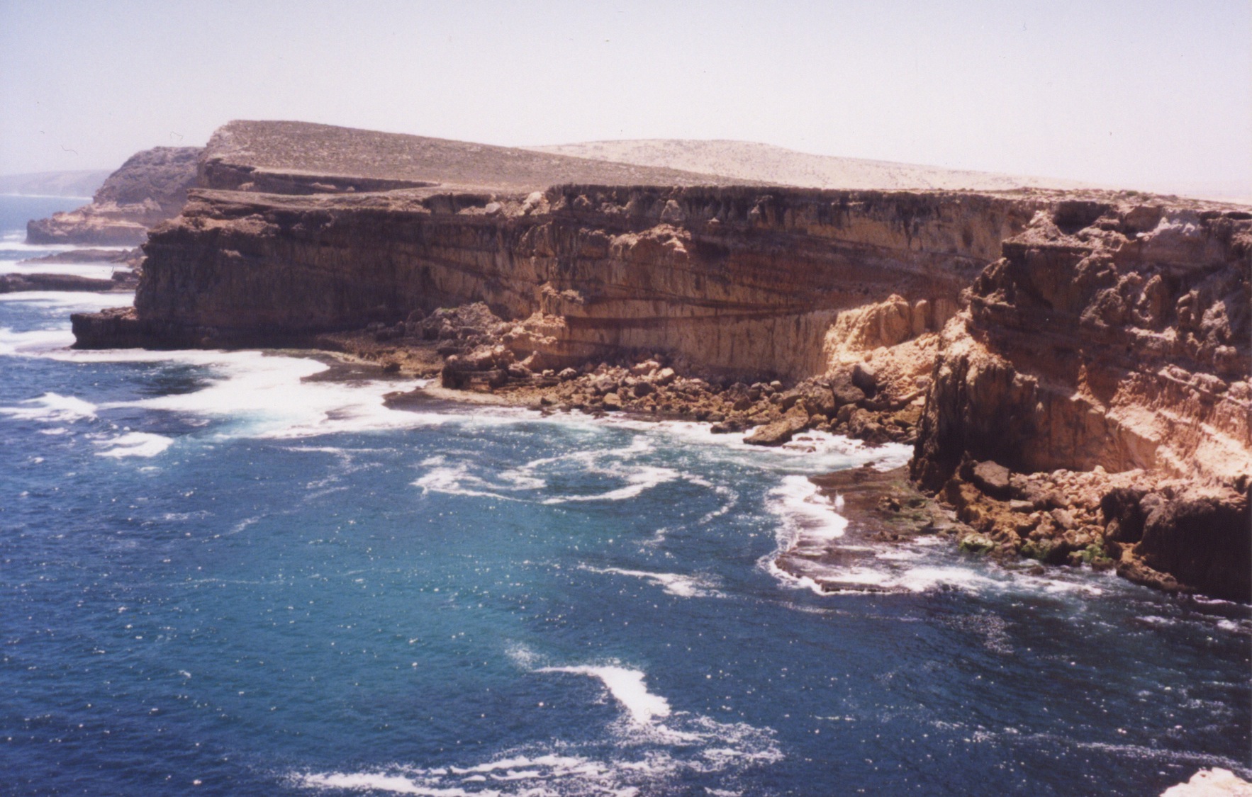
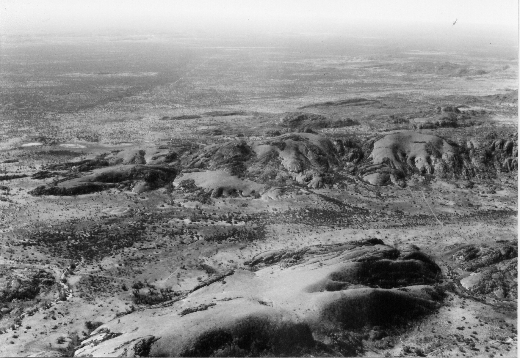
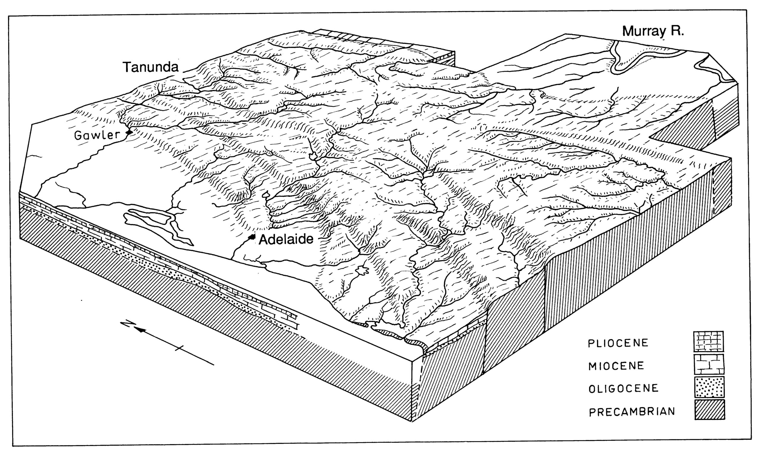
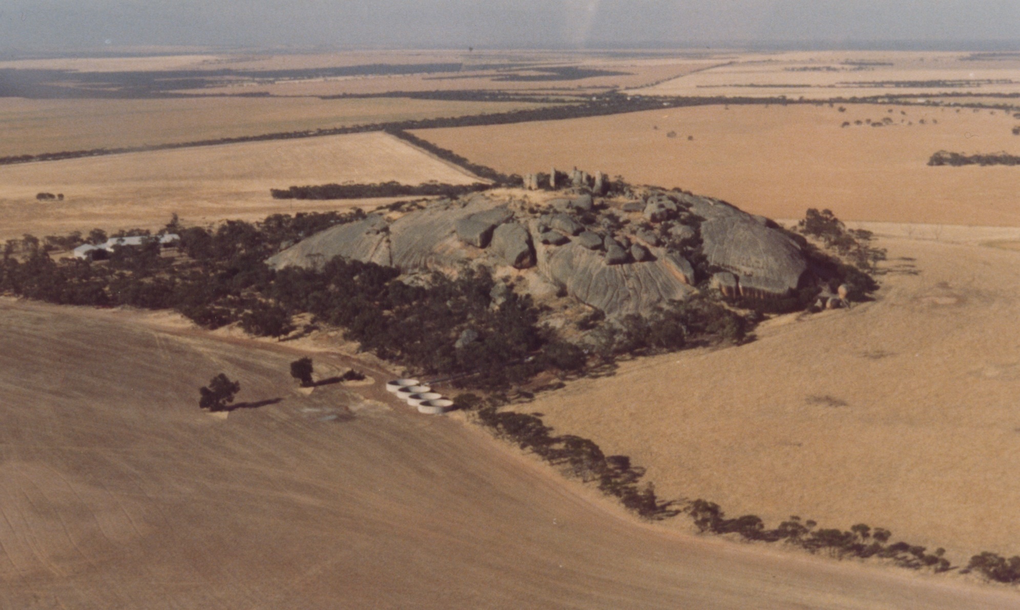
South Australian landscapes primarily reflect the underlying geological structure. The ranges of the northwest (Musgrave, Everard, Mann and Tomkinson) are founded on crystalline igneous and metamorphic rocks , and the Gawler Ranges on a mass of ancient volcanics intruded by granite, whereas the Mt Lofty, Flinders, Davenport, Lincoln and Cleve Uplands are developed mainly on folded and faulted sedimentary sequences. By contrast, most though not all of the great plains like those of the Murray, Officer and Eucla Basins (the last coincident with the Nullarbor Plain) and the Great Artesian Basin in the northeast are founded on relatively undisturbed strata, though the lowland that occupies central Eyre Peninsula is cut across crystalline rocks. Rock type finds expression also in limestone terrains like the streamless Nullarbor Plain (Figure 8) and the Murray Basin plains. Though underlain by various other rock types, extensive areas of Eyre and Yorke Peninsulas, like the Murray Basin plains, carry a limestone crust known as calcrete that also ‘swallows’ water to produce landscapes lacking surface streams. Granitic outcrops are distinguished by boulders and bald hills that rise abruptly from the plains – or the sea – and are known as inselbergs, or where dome-shaped, bornhardts, after a German scientist of that name.
The climatic factor
Past and present climatically induced processes left their mark on the landscape. Because of its mid-latitude position, its compact shape and the rain shadow effect imposed on the interior by the Eastern Highlands, Australia is the most arid of the inhabited continents. Most of the South Australian interior as well as some coastal areas are climatically arid, but in the Nullarbor and Murray regions this characteristic is reinforced by the calcareous character of the underlying strata.
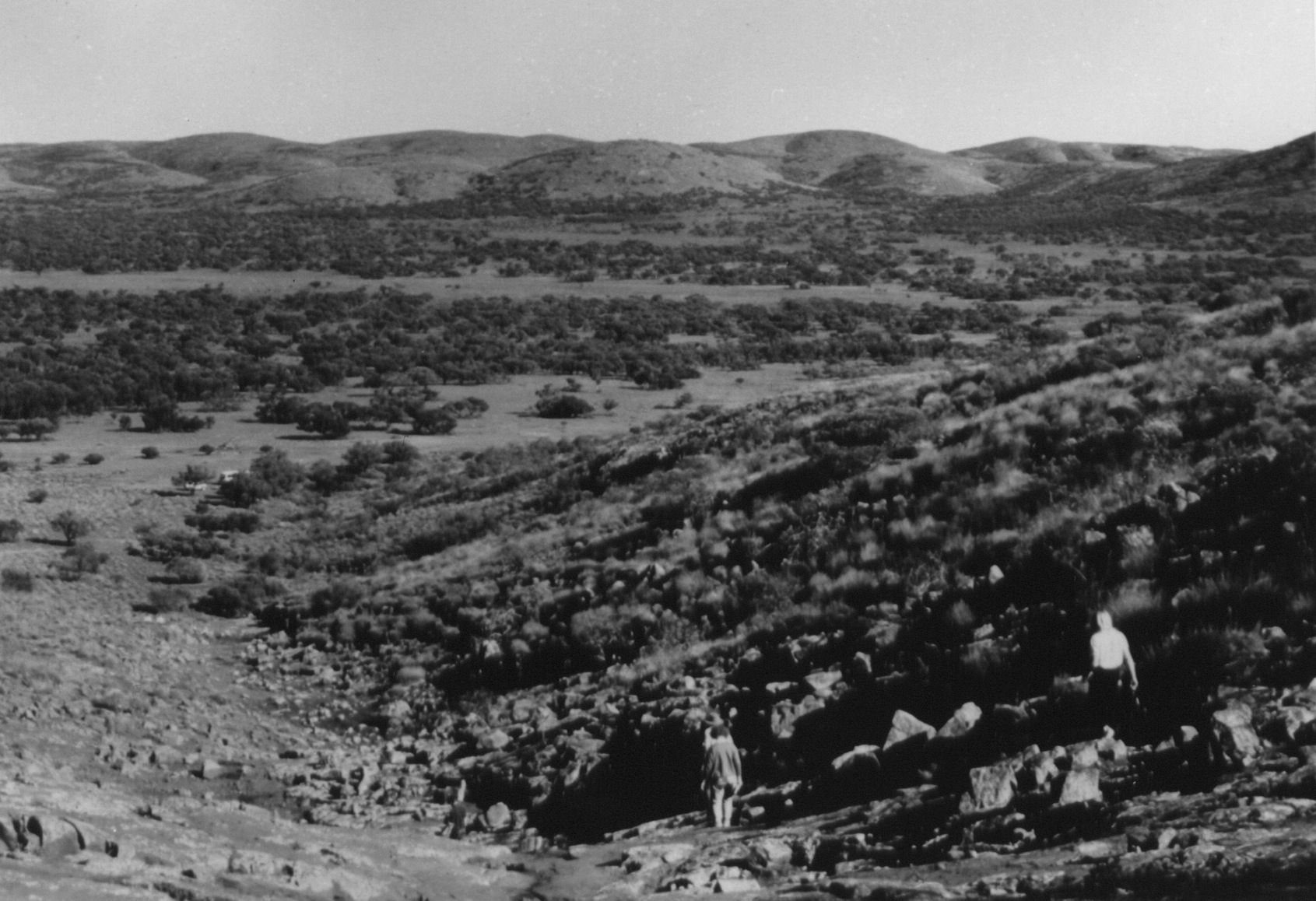
Fields of mobile dunes built of quartz sand characterise the Simpson and Strzelecki Deserts in the east and, in some measure, the Great Victoria Desert in the west. The vegetated and stabilised sand ridges that extend across northern Eyre and Yorke Peninsulas, the northern Adelaide Plains and the Murray Basin were active 250 000–25 000 years ago. The gibber plains of the northeast (Figure 2) and many other northern areas also are largely a product of aridity. They are mainly due to the winnowing of fine particles by the wind and occasional runoff, resulting in the concentration of coarse debris at the surface. In addition, in areas underlain by hydrophilic or cracking clays alternations of wetting and drying, swelling and contraction (gilgai action), cause churning. This has left gravels or other large fragments stranded at the surface forming a surficial carapace and the well-known gibber plains of such areas as Sturt Stony Desert.
Interspersed with the dunefields and the stony desert are numerous salt lakes or salinas and, notably, ‘lakes’ Eyre, Torrens, Frome, Blanche, Callabonna and Gregory. Large salinas are also found within the Gawler Ranges and Arcoona Plateau (‘lakes’ Gairdner, Acraman, Harris and MacFarlane, and Island Lagoon). Lake Acraman is especially interesting for it occupies the site of a meteorite impact 600 million years ago (mya). Though some now are mined for gypsum and halite, that these salinas are still referred to as lakes serves as a reminder that they promised much but delivered nothing but disappointment, for they did not provide usable water.
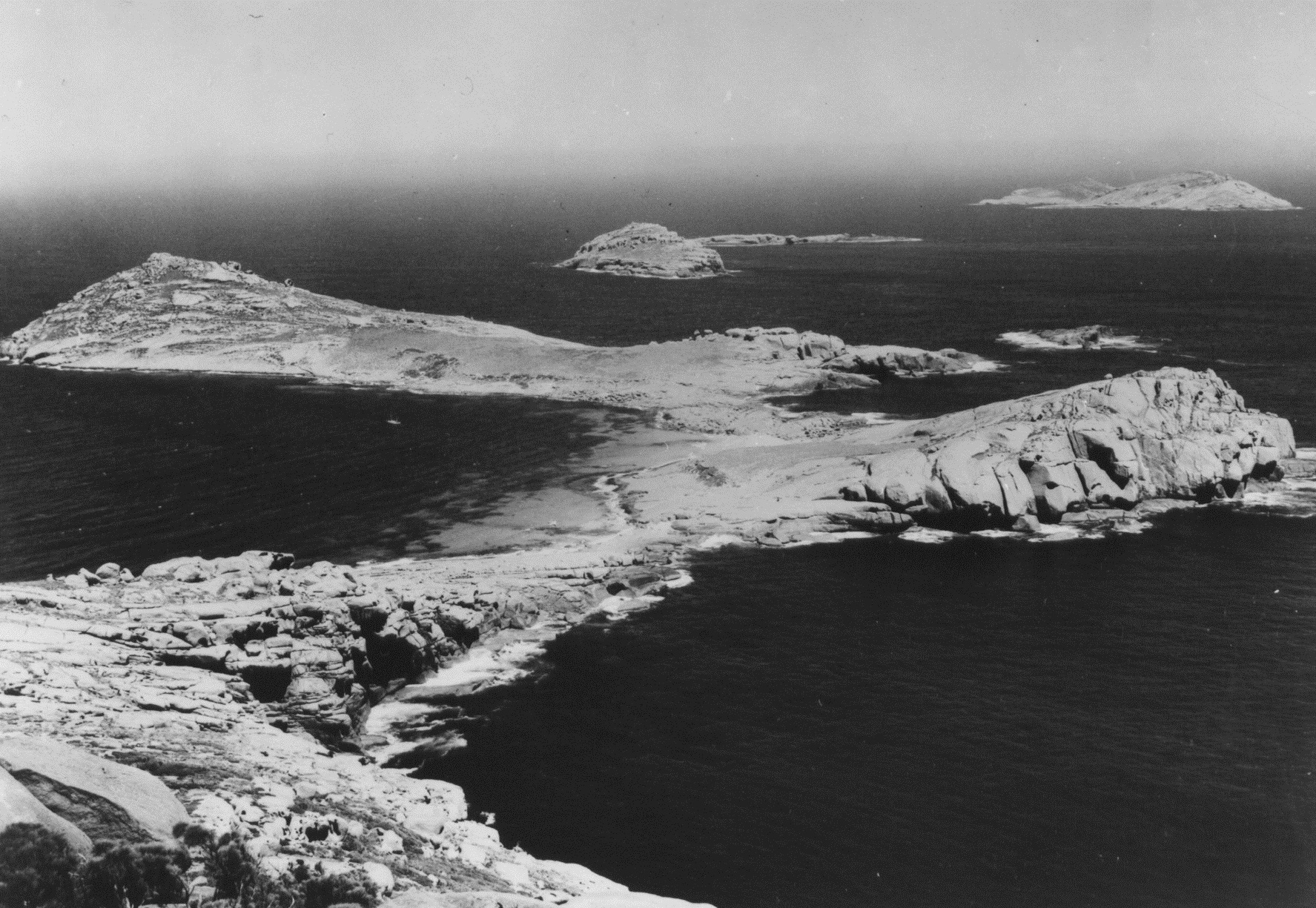
Cold conditions also produce typical landforms. The glaciations of the Quaternary period – the last 2 000 000 years or so – did not directly affect South Australia but the Permian glaciation, some 270mya, finds expression in the well-known striated and polished pavements of such sites as Hallett Cove and the Inman Valley (notably visible at Selwyn’s Rock). The ironstone or laterite of Kangaroo Island, the Mt Lofty Ranges and the Lincoln Uplands is a relic of humid tropical conditions that obtained in a later Tertiary development (2–5my old), whereas others consign the laterite of southern South Australia to the Triassic (with an age of c. 200my). The silcrete-capped plateaux of the arid northeast of the state and adjacent areas formed in the Eocene about 60mya and in humid conditions, but similar materials of much younger (Miocene) are reported from drainage channels in the north of the Gawler Craton.
An ancient land
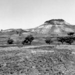
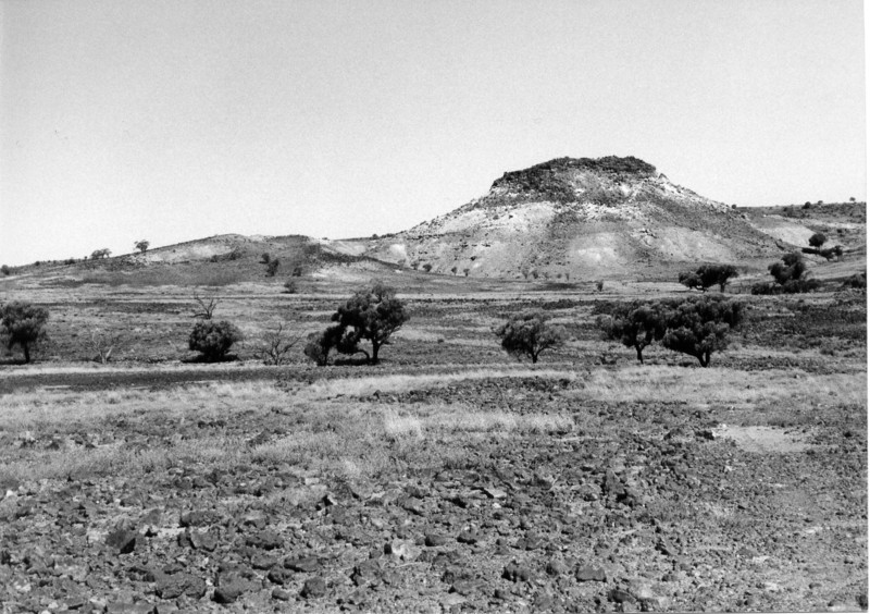
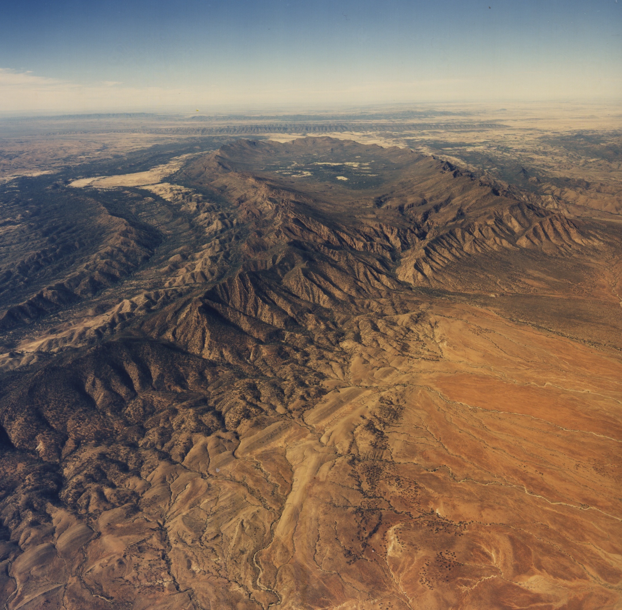
Many parts of South Australia are incredibly old. In addition to the old laterite-capped plateaux of the gulf regions, the ridge and valley topography of the Flinders Ranges was already established some 60mya and the rounded hills and bevelled summits of the Gawler Ranges (Figure 5) are from about 120–130mya. The Arcoona Plateau may be of similar age.
Lake Eyre
With an area of some 9324km2, Lake Eyre is the largest of the many South Australian salinas. The western margin is a dissected fault scarp capped by crystalline gypsum, the whole area has subsided and in Madigan Gulf the bed stands 15–16m below sea level. The area around Lake Eyre is hyper-arid (e.g., the average annual rainfall is less than 125mm), but the salina is the focus of a huge catchment, including large areas of monsoonal northern Australia. Rivers tributary to the lake like the Diamantina/Warburton and the Thomson/Cooper run frequently, fed by monsoonal rains and occasional incursions of rain-bearing systems from the tropics or the west. Runoff occasionally reaches the lower sectors of the drainage basin, bringing water and sediment (much of it sand that is eventually shaped by the wind into sand ridges) to this, the driest part of the continent, and the ‘lakes’ occasionally flood and live up to their name. The desert briefly blooms and surface and underground storages are restored. Because of the basin structure of the region, artesian and sub-artesian waters are available. Thus, though climatically arid the Simpson Desert and adjacent deserts are from time to time capable of carrying stock, particularly on agistment, and all are under pastoral lease.
The South East ‘ranges’ – interplay between crustal and sea level changes
The Quaternary period saw repeated fluctuations of sea level in response to the waxing and waning of ice sheets and glaciers. It was during such phases that inshore sectors of the former seafloor were exposed. Fragments derived from the disintegrated shells of molluscs were blown a short distance inland where they were trapped by vegetation and formed the foredunes built up behind west-facing coasts like those of Eyre and Yorke Peninsulas.
These calcareous sand ridges differ in composition and origin from those of the interior deserts. They also dominate the landscape of the South East district where they are known as ‘ranges’. Each declines in height to the northwest because during the Quaternary the region was tilted up in the southeast and down to the northwest. These earth movements possibly were associated with the volcanicity of the Mount Burr and Mt Gambier districts. Mt Schank erupted only a few thousand years ago and was witnessed by the indigenous population of the area.
Concurrently with this uplift, coastal dunes were deposited behind the shoreline beaches during high stands of the sea, but as the land was rising each successive dune was carried higher and further from the sea: hence the impressive suite of subparallel dunes separated by flats with numerous lakes and lagoons. The crescentic dunes or lunettes formed on the eastern margins of the lakes were dry sites selected for homesteads by the early settlers because prior to the excavation of drains the flats between the dune ridges were subject to frequent flooding.
River Murray past and present
The River Murray in South Australia is a permanent stream flowing through a gorge incised in an arid landscape (Figure 14). It rises in the well-watered parts of the Eastern Highlands and survives passage across the mostly calcareous arid and semi-arid interior plains. It is an elongate oasis, with life-giving water, fish and shellfish, and with natural shelters or alcoves etched into the base of the cliffs. The water also attracted game. Excavations of the shelter sites included one of the first, if not the first, based on stratigraphic principles. It was carried out at Devon Downs near Nildottie in 1930 by HM Hale and NB Tindale. This and later work demonstrated that indigenous people occupied the valley for several thousand years.
But the Murray Valley was not always as it now appears. About 5mya the sea level rose and the valley became an estuary that extended north of North West Bend and as far east as Overland Corner. Hence the thick beds of oyster shells in the lower Marne Valley, at Morgan and elsewhere. The Murray is Australia’s longest river but during (glacial) periods of low sea level it flowed some 200km beyond its present mouth to the edge of the continental shelf. There the turbid waters excavated huge canyons, 1.5km deep, in the continental slope.
Conclusion
The South Australian landscape reflects the influence of the underlying geology and climate, both of which have changed through time. Paradoxically, however, many notable landscape features have survived these changes and persist as ancient relics of past eras.

Comments